Editor's Pick
Apr 19, 2020
Revisited: How ‘Badass’ Scientists Climb Mountains to Fight Climate Change
Inspired by the "badass for science" label given to the American Climber Science Program after Dr. John All's viral crevasse fall video, Steve Byrne explores the true meaning of citizen science.
WRITTEN BY
Steve Byrne
Before you read, remember this: Independent editorial isn't free. If you enjoy this article, please consider creating an account to support our journalism so we can keep going.
Bloodied and broken, Dr. John All looks into a camera, “I’m pretty well fucked.”
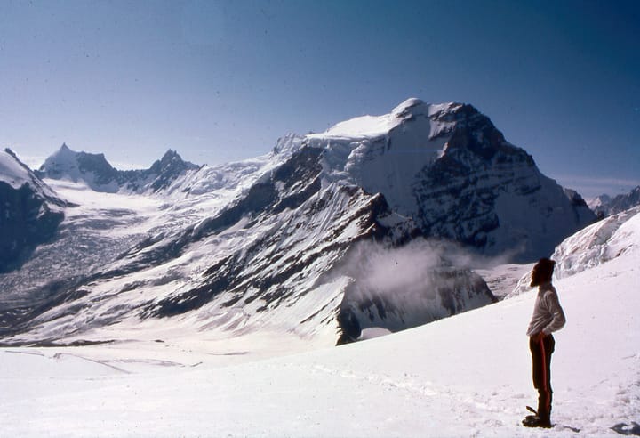
Dr. All, wedged deep in a crevasse between two icy walls, describes his lonely predicament. Some 70 feet above him light beams through the hole in the glacier that his body just punched through. Below, the blue and white hues of the glacier’s entrails fade into a deep blue, then black oblivion.
Exasperated and in constant pain, Dr. All assesses his situation, collects himself and plots a course back to the world. Despite a broken arm, cracked ribs and internal bleeding, he inches upward, groaning in pain as he swings his ice tools into the frozen walls. As he wiggles upward, softening snow near the top halts his progress. He adjusts course, shuffling over and up a few meters, connecting the layers of denser snow able to support his weight. The last few feet of sun-softened snow slow him briefly, but soon he hauls himself out of the crevasse that nearly consumed him.
From that high Himalayan glacier, Dr. All beamed an SOS via satellite to the Facebook page of the American Climber Science Program. A rescue scrambled and later plucked him from the glacier to a hospital in Kathmandu. Not long after, video of the crevasse climb soon spread around the web and media outlets labeled Dr. All a “badass for science”.
This painful, first-hand video was my first real impression of the American Climber Science Program. A month or two earlier, I had decided to join the ACSP as an expedition photographer to the Cordillera Blanca of Peru. I was interested in glacial watersheds and the program looked like a unique way to climb in a beautiful part of the world and photograph one of my favourite subjects: glaciers. Dr. All’s incident added a little extra spice to my curiosity and anticipation of the expedition.

What sort of research was taking these scientists into such high, extreme environments where most climbers are content to just climb? What can be learned from doing science so high up? What exactly is this media label, “badass for science”?
One evening in August 2014, I rolled into Huaraz, Peru on a bus from Lima. With an address and vague directions in hand, I wandered through town until I found the expedition’s guesthouse. The owner and his wife welcomed me warmly and informed that the team was still in the field. I had a few days to acclimatise and rest before heading into the mountains.
While I waited, I explored the city and surrounding valley, photographing landscapes and people. Huaraz is nestled in a high, arid valley between the Cordillera Blanca, whose tropical glaciers hang like permanent clouds over the patchwork of terraced fields and villages, and the Cordillera Negra, a less impressive, drier range, devoid of the vegetation and glaciers that attract one’s gaze skyward in awe at the Cordillera Blanca.
Just as I was beginning to grow restless, the expedition team returned to Huaraz. Dirty, wet and tired, they had just spent much of the past week hunkered in tents waiting out the weather. I met the crew and spent the following days feeling out the dynamic of the team spending warm afternoons relaxing on the guesthouse rooftop, cooking food, drying and sorting gear and throwing back a few watery Peruvian beers.

Undergrad and grad students comprised the majority of the team, led by two older scientists, Dr. Carl Schmitt, Dr. Rebecca Cole and seasoned climber David Byrne. Everyone came to further research in a variety of specialties: freshwater micro invertebrates, water quality, grazing practices, alpine ecology and black carbon accumulation on glaciers. The variety and scope of the research projects blew me away. Most researchers had been in the region for the entire summer, studying each valley of the range one week at a time. I had arrived just in time for the final week of the expedition.
The following morning we drove deep into the mountains, establishing base camp in a high meadow of the Llanganuco Valley, surrounded by peaks rising sharply over 20,000ft. From camp, the team would spend the week fanning out across the entire valley in smaller research groups of both Peruvians and Americans. The groups collected samples and studied alpine water, macroinvertebrates, snow and plant samples. As we assembled base camp and I spoke with many of the scientists, I learned that the Program served as an incubator and logistical platform from which a whole range of focused, alpine research became possible.
As late afternoon shadows began filling the high alpine valley, the team gathered in base camp over a warm meal and never ending cups of tea. During dinner, Wilmer Sanchez Rodriguez, a student at Santiago Antúnez de Mayolo National University in Huaraz, recounted that each year since childhood, he’d witnessed glaciers in the Cordillera Blanca retreat at an accelerating rate. The omnipresent view from town is slowly morphing, day by day, to show more rock and less snow. Wilmer continued recounting how some villages are now unable to use their streams for farming and livestock: naturally occurring compounds in rocks previously covered by glaciers are leeching out into streams now that the rock is exposed to runoff.

I had no idea that things were happening so quickly, nor that changes in climate could affect water quality in addition to availability. Very quickly, I understood that a changing climate and human impacts on alpine environments have far more lasting effects than just water availability. And as the conversations over tea continued, Dr. Schmitt and Wilmer filled me in on the effects of local air pollution on the mountains.
Black carbon: fine, airborne particulate matter, is a bi-product of combustion that mixes with weather systems and precipitates out in rain and snow. In alpine environments, precipitation typically falls as snow, and as it accumulates on the upper slopes of a mountain, the snow compresses into ice and begins to move downhill: a glacier is born. As storms dump layer upon layer of snow on glaciers, black carbon in the snow can concentrate, darkening the surface of glaciers, causing them to absorb more solar radiation, increasing melt rates.
Measuring and mapping black carbon on glaciers both in the Himalaya and Cordillera Blanca has become a centerpiece of the ACSP’s annual research. Here in the Cordillera, Dr. Schmitt and his teams have criss-crossed the entire range sampling glaciers, returning to base camp to filter the meltwater and map black carbon concentrations throughout the range. Over the past few years, Dr. Schmitt has been gathering data to prove the hypothesis that glaciers nearest urban and industrial centers tend to have the greatest concentration of black carbon, and thus could be at greater risk of melting faster—and disrupting water supplies—faster than would happen otherwise.

Itching to climb and curious to better understand the research, I joined Dr. Schmitt and company up Cerro Pisco, a beautifully glaciated 18,000ft peak at the center of the Llanganuco Valley. To complete the climb, with the help of our porters, we establish a higher base camp, putting us within striking distance of the summit.
As we haul our camp up valley towards Pisco, grey clouds envelop the surrounding peaks and it begins to snow. We reach a high, flat bench and break for a quick lunch inside a small hut, sipping tea and chewing coca to mellow the affects of altitude. We discuss the weather and how it might affect a summit attempt, then decide to push onto high camp.

Slowly plodding into the increasingly thin air, we haul our heavy packs up and over unstable moraines of talus and scree, occasionally shifting beneath our feet, evidence of previous glacial periods. As we gingerly scramble over the moraine, thundering avalanches of rock and ice cascade down the flanks of the Huandoy group, three peaks stretching nearly 20,000ft high, standing guard at the head of the valley we cross.
An hour before dusk, we arrive at a small, protected flat where a trickle of water flows out of the glacier above with a few tent footprints marked out by small rocks. Thick, cake-like glaciers are pasted onto the impossibly steep walls of the mountains above, adorned with flutings in strange shapes on each ridge and subridge. The low rumble of distant avalanches across the valley interrupts the soft chatter of the team. Just before dark, the air begins to radiate: a soft, red glow bathes us all and streams of magenta clouds accent the frosted ridgeline above. When the final light fades, we quietly retire to our tents.
Around 3am, we awake to a cold, clear, night sky. Only my breath interrupts the still predawn. The team ascends from camp through the darkness with headlights dancing upward. At the glacier, we take a quick break, put on our crampons, rope up and begin the meditative rhythm of climbing: Step, step, breathe.

Beneath, the snow glistens, appearing to reflect the crisp, collective glow of the stars above. Reaching the summit ridge, ribbons of pink, red and orange paint the horizon over the Amazon to the East.
From the col, the summit ridge wanders around crevasses and precariously suspended blocks of ice. Tethered together, we wind our way through the maze up steadily steepening slopes until a final pitch ends in a small, round, flat area. The summit. We hug, tap ice axes and take in the view. The excitement and satisfaction of climbing an 18,000ft peak in the Andes had nearly overtaken me when Dr. Schmitt shouted, “hey, now the real fun begins. Time to sample snow!”
On the broad summit, he found an area of undisturbed snow, scraped at it with his axe and collected it into a labeled ziploc. He repeated the process after scraping down a few inches for a subsurface sample as I stand watch, photographing and thinking,
“this has to be the most beautiful office in the world.”

As we descend through the maze of crevasses, seracs and exposed ridgeline, Dr. Schmitt stops at predetermined locations repeating the sampling process, each time adding kilos of snow to his pack to be melted, filtered and analysed in camp. The high, tropical sun rises directly overhead, and the snow surface softens. Avalanches of rock and ice occasionally thunder down nearby peaks. As the light grows harsh, I stop photographing and turn my attention to the immense scenery that surrounds me. Looking out towards terraced hillsides and towns far below, I spot the transition where glaciers end and rivers begin. My eyes follow the water courses down and out to the horizon into the green, terraced hillsides far below: the connection between people and the alpine glacier I stand on could not be more obvious.
By late morning, the team reached the toe of the glacier announced by the scratches of our steel crampon spikes meeting granite once again. Hours later with muscles weary and a salty, dusty face, I returned to high camp, dropped my pack and finally indulged in sitting, legs outstretched on soft meadow grass. Before dinner, I joined the team in the mess tent and at the end of a quick recap of the day, Dr. Schmitt pulled out an unmarked bag of snow, some empty Nalgene bottles, and one of our porters presented a bottle of pisco.
You can’t successfully climb Pisco without having a pisco sour made fresh with the snow directly from the summit,”
We mix and shake the snow, pisco, lime and sugar and toast to a successful climb. The remainder of the evening is spent melting snow samples from Pisco, filtering the water and recording the levels of black carbon present in the snow.

During the summer of 2014, ACSP climbers and scientists collected dozens of snow samples from peaks along the entire length of the Cordillera Blanca and on each expedition, local students learned the basic technique for monitoring their glaciers and the most precious resource they provide, water. Each year, the body of black carbon data across the tropical Andes grows, and with the cross cultural exchange of ideas and scientific research methods, so too does the Peruvian knowledge of how to climb, sample and understand human impacts on glaciers and the water supply for local communities.

While the impact and value of the “badass for science” label might have turned heads and garnered fleeting interest after Dr. All’s fall, my time with the team in Peru taught me what the label really means: conducting and inspiring citizen science. The ACSP and its members put themselves in risky situations not for themselves, but to teach communities dependent upon alpine resources how to monitor and understand the effects of a rapidly changing world on their home.
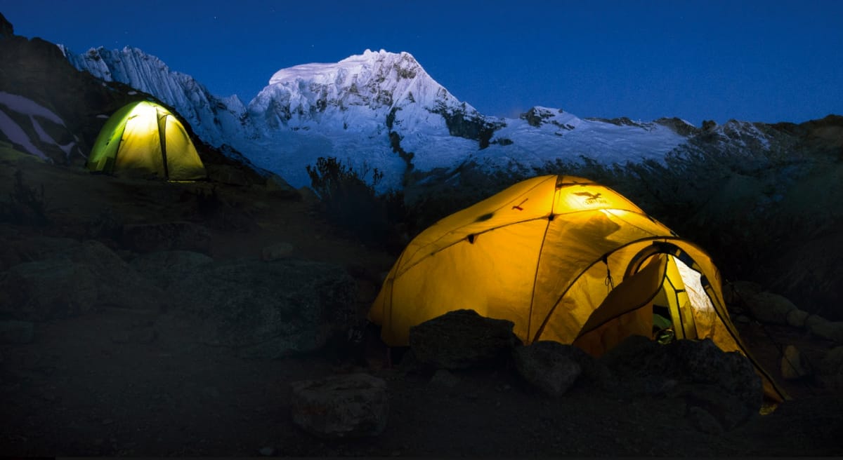
Feature image: Ranrapalca looms over camp at dusk on the eastern flanks of Vallunaraju. Cordillera Blanca, Peru. By Steve Byrne.