
On earlier trips to Himachal Pradesh’s glaciers, I had seen a mountain looming distantly and ominously. A friend told me it was called White Sail, and for more than a decade, I dreamt of mounting an expedition to climb and ski this magnificent mountain. Only later did I find out the local name for the peak and its twin: Dharamsura and Papsura, or the “Peaks of Good and Evil.” In the spring of 2013, my dream became a reality. The North Face agreed to sponsor the expedition to White Sail and we assembled a team of experienced athletes and friends, namely Giulia Monego, an Italian skier and climber from the Dolomites, Emilio Previtali, an Italian telemarketer, Johnny Collinson, a young and ambitious skier from Salt Lake City, Chris Figenshau, an accomplished photographer, mountaineer and skier, as well as two filmmakers associated with Sherpa Cinemas, Anjin Herndon and Jay Trusler.
Maps of the Indian Himalaya are very difficult to come by for reasons of “national security,
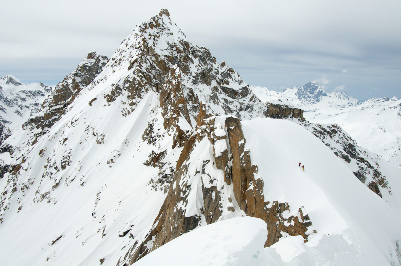
With the team in place and the date for the trip set for the month of March 2013, it was time to start planning in earnest. Detailed maps of the Indian Himalaya are very difficult to come by for reasons of “national security,” so I was left to pour over Google Earth, trying to figure out the best route for such a remote objective. At 21,186 and 21,252 feet respectively, White Sail and Papsura towered over their neighbours. I had only a single photograph of White Sail and as I matched the photo with the images on the screen, it appeared that the photo undeniably matched with the taller of the twins, Papsura.
I also learned that these two striking peaks are often confused. In Lahaul, the Peaks of Good and Evil are said to vary in height according to how good and evil prevail in the world. Angel or demon, the objective was still the same: to climb a new route on Papsura for a first-ever ski descent of the 2,000-foot couloir splitting the face.
The logistics were daunting. We had to go in March so as to have enough snow on the glacier and the peak for skiing but those same conditions made the normal summer approach to the Papsura cirque impossible. In the end, we opted to use a helicopter to access our base camp on the Chhotra glacier, just north-west of Papsura and Dharamsura. Himachal Heli, operating out of Manali, which is a popular tourist destination in the northeast region of India, was the obvious choice to help us with our expedition. Their experience flying in this region over the past 20 years proved invaluable—but there was a catch. They would fly us in but, because their operating season ended shortly after our drop off date, they would not be able to fly us out.
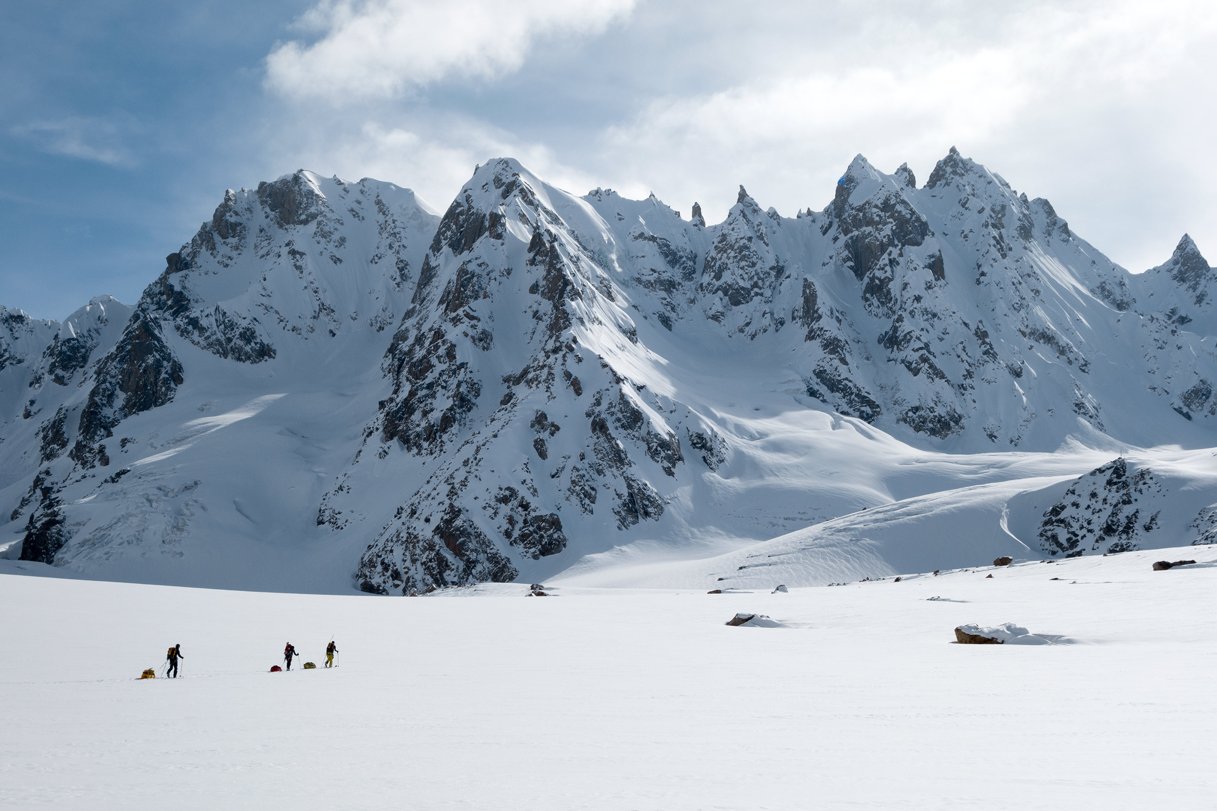
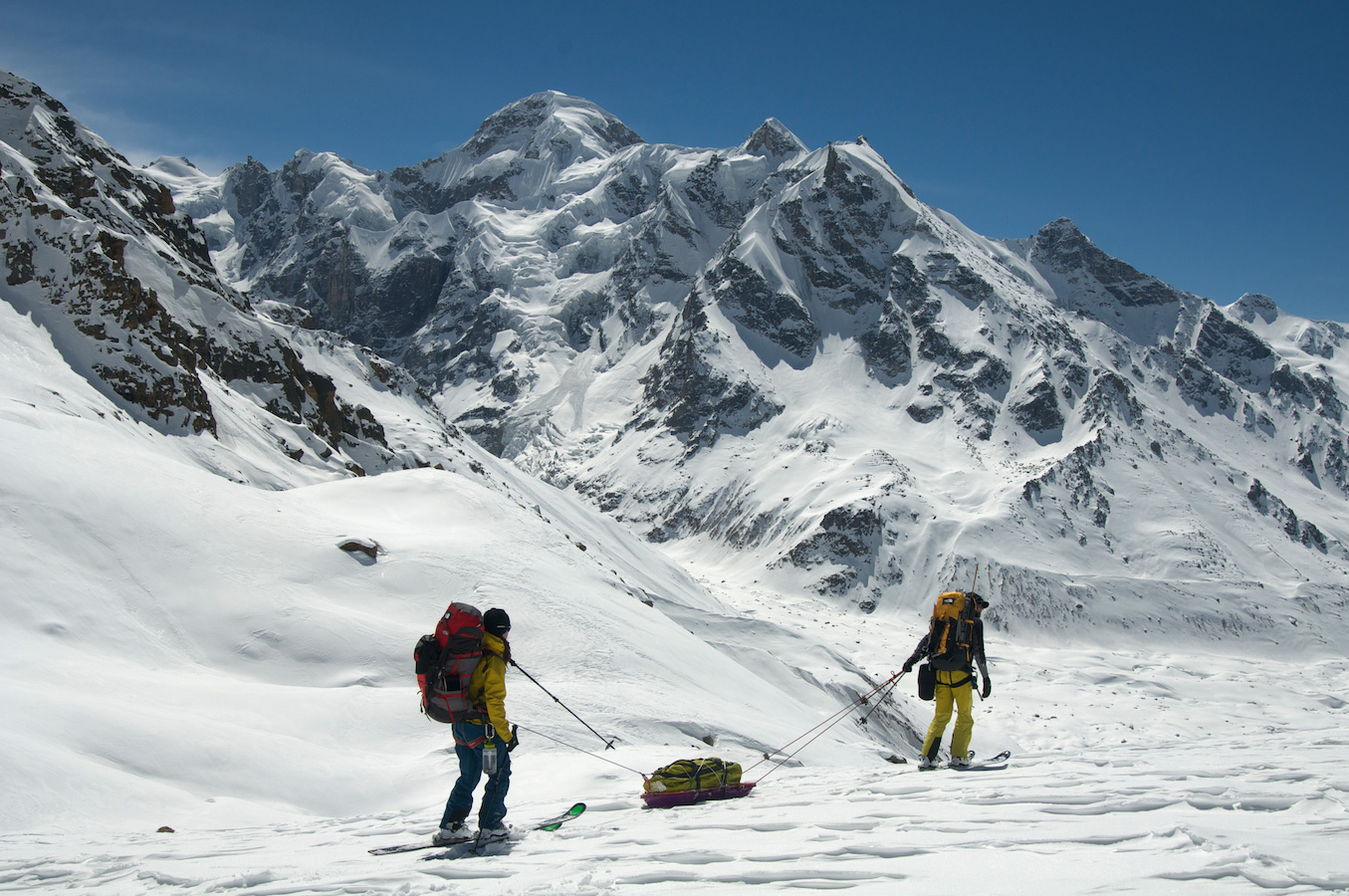
Still, in the throes of winter, there is no exit from the Chhotra Glacier so we knew we’d have to complete a traverse, one that had never been done in winter. Travelling north-to-south, we would cover roughly 40 high-altitude miles across three different glaciers. This meant foregoing the ease of a single base camp for a minimum of six different camps during the 12-day traverse. In the middle of this traverse was our objective: the 21,252-foot Papsura, or Peak of Evil. Finally, on March 12, 2013, I found myself in one of Himachal Heli’s choppers, flying over the same towering mountains where I had gone on my very first expedition, as a young woman some 14 years earlier. Now, with more than 30 expeditions under my belt, it felt like another lifetime. The sensation was overwhelming.
There is nothing gentle or subtle about the place.
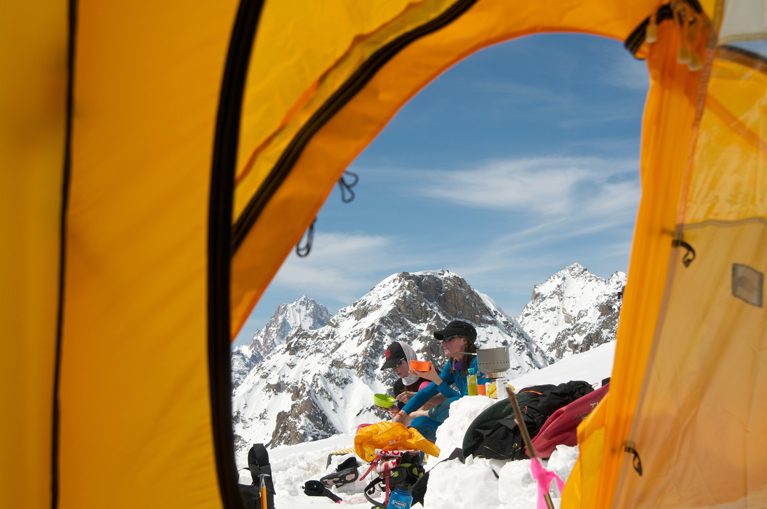
The helicopter flight took about half an hour but it seemed like an eternity, putting an exclamation point on how remote we really were. In addition, our base camp elevation was over 14,000 feet, significantly increasing the chances of altitude sickness. This far from civilization, the radio I carried was useless—once the helicopter left us to return to Manali, communication with it would be impossible. We were simply too far away.
My experience with the Indian Himalayas is that there is nothing gentle or subtle about the place; the colors, the noise, the mountains, and the weather are all in your face all the time. This time was no different. Overnight, 20cm of new snow had fallen and the storm was still raging. By midday, we could hear huge avalanches rumbling down the steep cliff faces on the east side of the valley, unnervingly close. By nightfall, there was a meter of wet snow burying what now felt like a very small and exposed camp. After a day hunkered in our tents, we stepped out into the storm simply to stretch our limbs. The sun was setting.
Right then and there, a massive rumbling roared across the shadows of the approaching night. We could see just enough to know an avalanche was headed straight for us and we had nowhere to go. We all turned our backs as a blast of blinding wind hit us but the feared wall of snow never came, and as the wind died and the air cleared, we could make out a tail of debris 200 meters in front of our camp. In stunned silence, Chris handed me a flask of whiskey and I took a big swig before crawling into my tent for a sleepless night.
The next morning we woke to calm blue skies and a pristine world of white. We could see that the avalanche had been much bigger than any of us imagined but as it hit the valley floor, the snow was diverted by a massive berm that we couldn’t detect the night before. Giulia had chosen our basecamp very well.
Either we attempted the unknown descent through the Sara Umga La Pass with the stable-but-sick Johnny, or we called in the helicopter for a rescue
Despite needing more time to acclimatize, we all eagerly agreed to move camp up the valley, where the glacier widened and offered more protection from the steep, snow-loaded peaks on either side of our initial location. Over the next two days, we moved our camp steadily towards the Sara Umga La Pass at 16,500 ft. This was our most crucial camp because it was the gateway to our exit out the Tos glacier and civilisation. But, as we neared the pass, I noticed that Johnny, normally very strong and leading the pack, was trailing far behind the group. I dropped my load of gear and skied down to him. As I reached Johnny, the look on his face told me things were not so good. His breaths were shallow and wheezing and his lungs bubbling, all telltale signs of pulmonary edema.
The condition, an accumulation of liquid in the lungs, is common to high altitude mountaineering and can cause fatigue, insomnia and even respiratory failure. The only cure is to descend but our options were limited: either we attempted the unknown descent through the Sara Umga La Pass with the stable-but-sick Johnny, or we called in the helicopter for a rescue—the only safe option. But we were out of range for radio communication. There was, however, one emergency option.
There are a lot of seemingly irrational laws in India. One of them makes satellite phones, in a similar fashion to explosives or firearms, so illegal that they are not even allowed in the country. Because of the remote places I climb, I always carry a satellite phone for emergencies and to have contact with my family. As a result, I have traveled all over the world with satellite phones and it never occurred to me, in planning this trip, that India would have a different set of rules. When I landed in Delhi and saw the customs forms explaining in detail that sat-phones are illegal, I made a quick decision to not declare the phone—there was no way I was going on such a remote expedition without a source of communication in the event of an emergency.
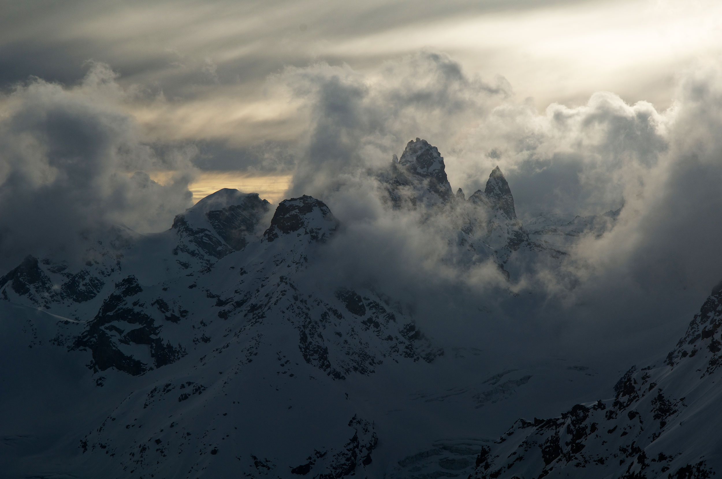
One of the more magnificent and fearsome places I had ever seen
With Johnny’s condition critical, we found ourselves with no choice but to use our smuggled satellite phone. Afraid to call for help within India, we transmitted our call for a helicopter evacuation through a friend in Italy. A pickup was scheduled for the next morning. That night I shared a tent with Johnny, giving him meds every few hours to make sure his condition remained stable. The morning was blissfully clear and calm, it was decided that Emilio would accompany Johnny on the flight out. The heli showed up and within minutes, we’d lost two valuable members of our team. We were down to five.
At camp, we solemnly discussed if it was even worth crossing the Papsura glacier for a better look. In the end, we decided we had come too far—the Papsura cirque was one of the more magnificent and fearsome places I had ever seen and we needed to, at the very least, stand at the base of the face.
The next morning we made our way through the maze of crevasses leading to Papsura, a route that led us under the objective hazards of hanging seracs – huge blocks of unstable ice that could fall at any moment. Chris, with a pregnant wife at home, felt it wasn’t worth it and headed back to join Jay on the ridge. Anjin, Giulia and I continued into the shadow of the peak and past the debris that had slid from the face the day before. Tied together, a hundred feet below the bergschrund and at the bottom of a 2,000-foot face of ice, snow and rock, we decided to get the hell out of there. the locals knew what they were talking about—the Peak of Evil was a far more apt name than White Sail.
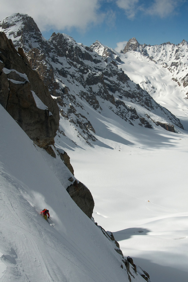
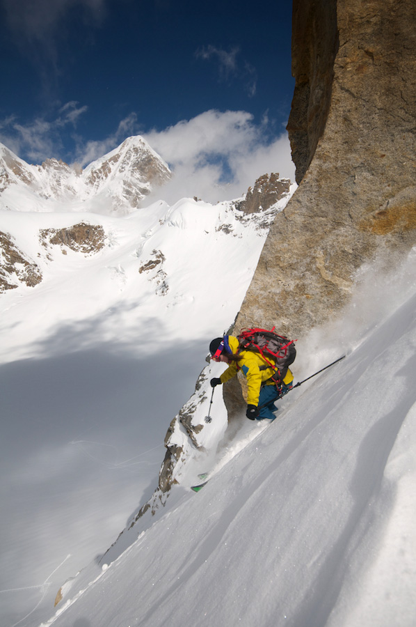
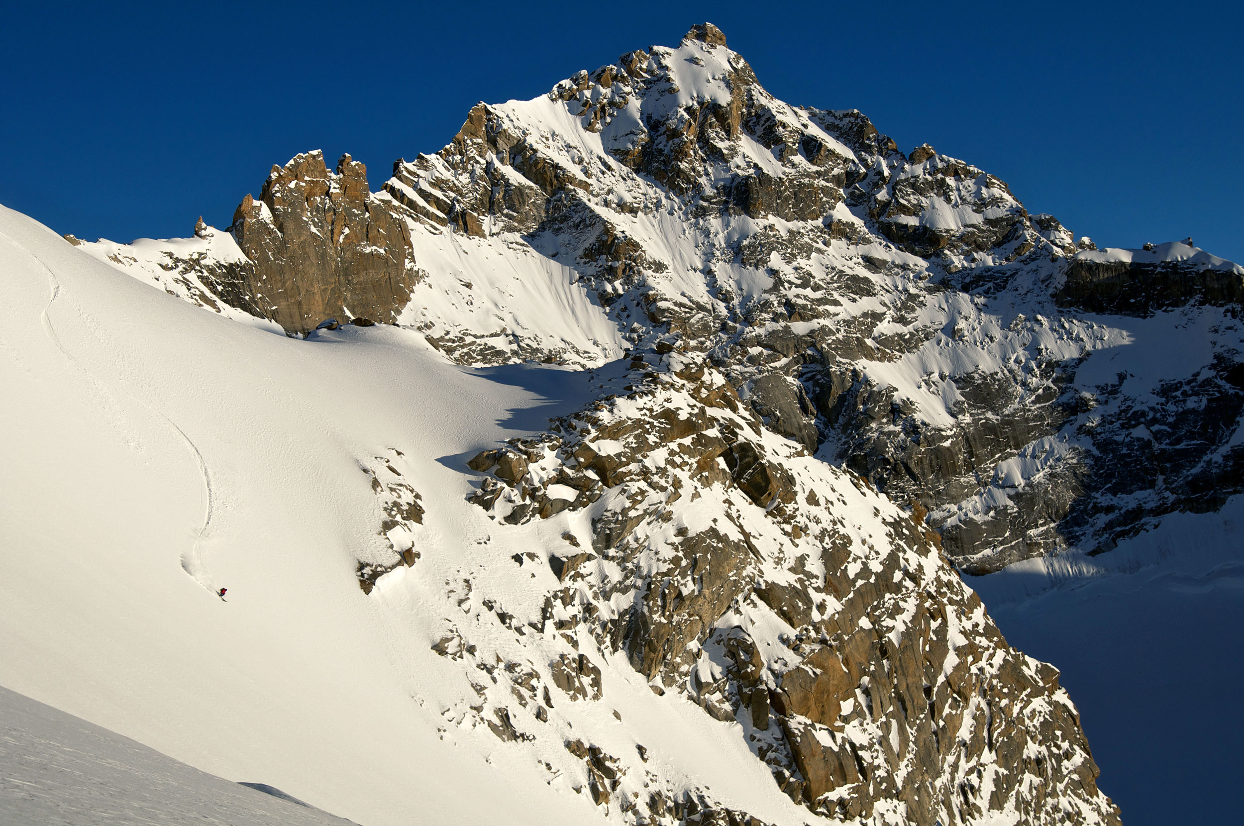
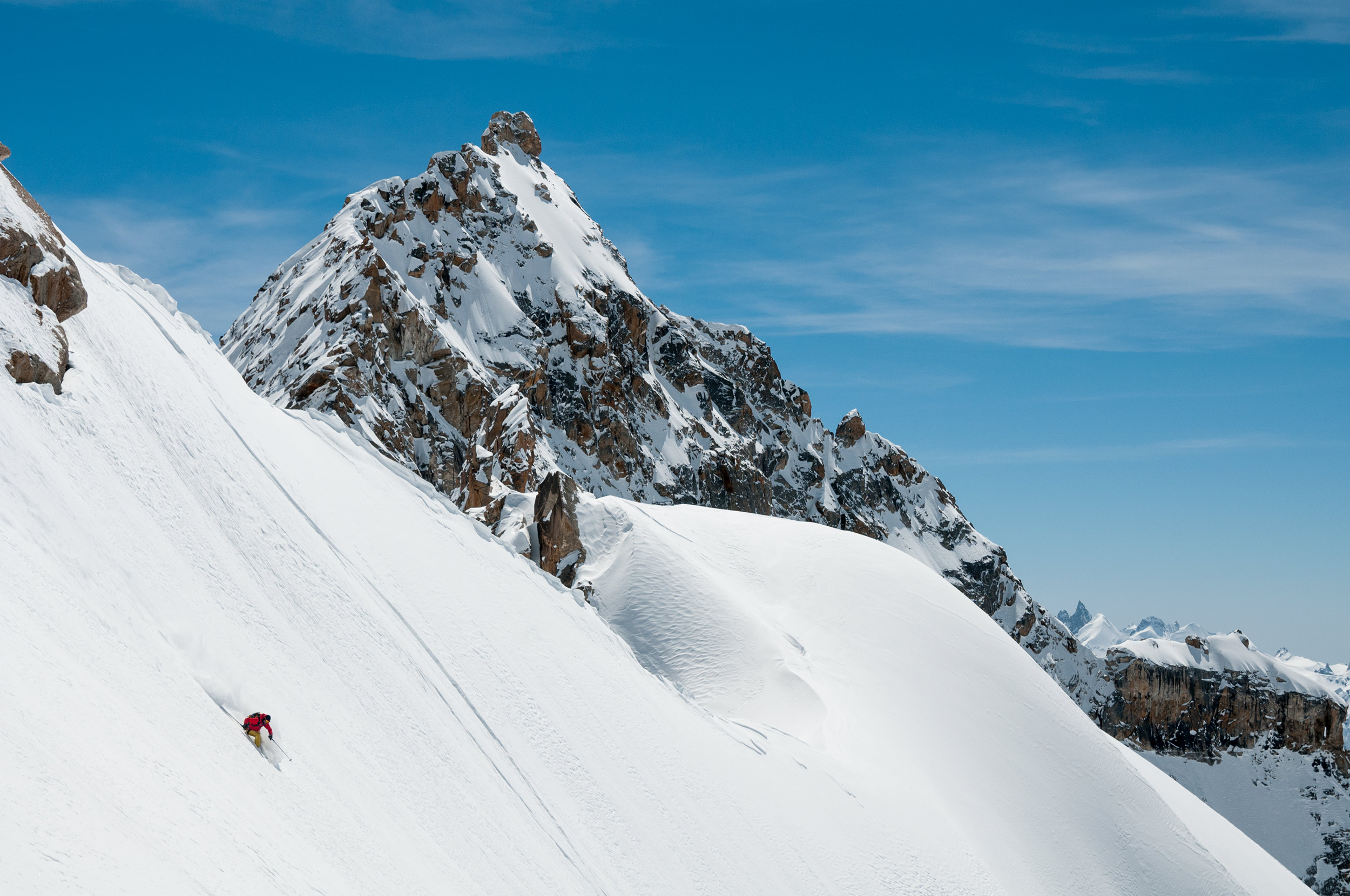
Facing those immense obstacles, it would’ve been suicidal to go farther. Still, we knew the expedition was far from over. We’d been going uphill for days and felt that it was time to start having some fun. We found a variety of amazing ski descents between 19,000 and 16,500 feet where the snow was velvety powder. We remained at our high camp a few more nights and soaked up the sun and the views.
Eventually, it was time to pack up and finish the last leg of our adventure. We knew a storm was approaching and that the route ahead of us was largely unknown. On the morning of March 22, ten days after our journey began, it was time to embark on the traverse that would lead us back to civilization.
we clung to the sides of the valley with our skis.
It began with a 2,000-foot descent from the Sara Umga La Pass, faltering through breakable crust with sledges of gear strapped between us. From there, we landed on the Tos Glacier and, for 10 miles, we followed the undulating ice in sweltering heat, stripped down to our long underwear. Our sledges did not like the terrain and we struggled as they flipped and spun in protest. The endless, untouched ski descents surrounding us were the only things distracting us from our misery. By mid-afternoon, we came upon the first signs of the rushing Tos river as the glacier came to an end and the valley finally began to descend. naively, we decided to push on.
The wide valley narrowed and steepened as the river swelled, a shooting gallery of wet slides spanning the Tos’ boiling waters. The weight of our sledges threatened to topple us over the precarious incline and towards certain death below. Eventually, we had to shoulder the monstrous sledges as we clung to the sides of the valley with our skis.
A few more hours and we were exhausted; we had dropped 6,000 feet over 12 miles, all in 8 hours. We found a small, relatively safe spot to set up camp and lick our wounds—and polish off the litre of whiskey we’d been hauling around, our previous high altitude headaches preventing us from consuming it earlier. It would be our first time sleeping below 14,000 feet in nearly two weeks.
The next day, after a tense discussion of whether to continue along the river or struggle up the valley walls, we left the dreaded Tos for the surrounding ridge tops — and, we hoped, the teammates and porters who had stuck to the ridgeline.
About an hour into the climb, Anjin crossed a set of very fresh bear tracks. Instead of turning tail and heading the other direction, we decided to follow the bear. It probably had a lot better idea of where it was going than we did. Within five minutes we were cresting an obscured ridge, where we immediately ran into Johnny and Jay, local guide and guru Khem Sing, a group of 10 porters, and Happy, our Liaison Officer from the Indian Mountaineering Federation, or IMF. The bear, it seemed, knew exactly where he was going.
I have never been so willing to hand off my pack nor so relieved to see a familiar face. The porters must have thought we were a little insane as we jumped for joy and, after 48 hours in the terror of the Tos Valley, perhaps they were right.
The weather held for our final night as we gorged on an amazing dinner next to the raging campfire, sharing stories and laughing in the maniacal way that comes from having been so close to the edge. By morning our tents were once again covered under a foot of unseasonable wet slush, and while hiking through the slippery mud and snow in our ski boots was less than ideal, imagining the dire straights we would be in had we not escaped the Tos banished any misery.
It took another night and two days before we reached running water and electric lights, reflective surfaces and clean clothes. I walked right past the point where this adventure had started, 14 years ago, when I’d first looked at the peaks and dreamt of climbing them. In the years spanning my different voyages into the heart of the Indian Himalaya, I’ve learned that in order to appreciate the good, one has to endure a little evil.
Feature Image: Giulia Monego walks an unknown ridge over the Tos Glacier at 18,500 feet.
All Images © Chris Figenshau
This story was a Feature in The Outdoor Journal Winter 2013 print edition.


