A Hitchhiker's Guide to the Suunto Ambit 2S
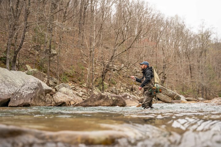
Climbing the highest peak of Morocco, the Atlas Mountains and North Africa, Mt. Toubkal (4,167m) with a Suunto Ambit 2S.
While on an expedition in the implausibly scenic country of Morocco, I had the opportunity to climb Mount Toubkal- the country’s highest mountain. At 4,167m, it’s a “hike” in the summer. But in November, it’s icy, slippery, snowy, and cold. The highest peak of the Atlas Mountains and North Africa, it took two days to climb the beast. The first day is a long hike up to the refuge and the second day is a five to six hour climb to the summit. Being an avid climber and skier, I had never used a GPS watch before, so I decided to take it up what I thought was going to be yet another fourteener. Oh, how I was mistaken. Oh, the humanity!
Using a Suunto Ambit 2 S for these two days changed everything. I usually don’t care how fast I’m going, what my average speed or altitude is, and I most certainly don’t worry about which direction I’m headed. This is mostly because I had always entertained the idea of being one with nature without technology- oh how my dirty hippie notions were misguided. I soon realized this was probably the easiest way to end up lost in the wild, filled with regret, living on poisonous mushrooms and strange herbs- wishing I had cared about those things and bought myself a GPS watch, instead of befriending Wilson the volleyball. I found options for timers, a logbook, a compass, and navigation in the Start menu. The “Exercise” option allows for special modes like triathlon, indoor training, running, outdoor swimming, cycling, indoor swimming and “other sports”. Built primarily for triathletes, I mostly used the “other sports” function that included hiking, walking, weightlifting etc. This suited me the best as it gave me all the necessary information I desired. To use the heart rate monitoring option, one must buy an external belt to tie around the chest, for about $90.
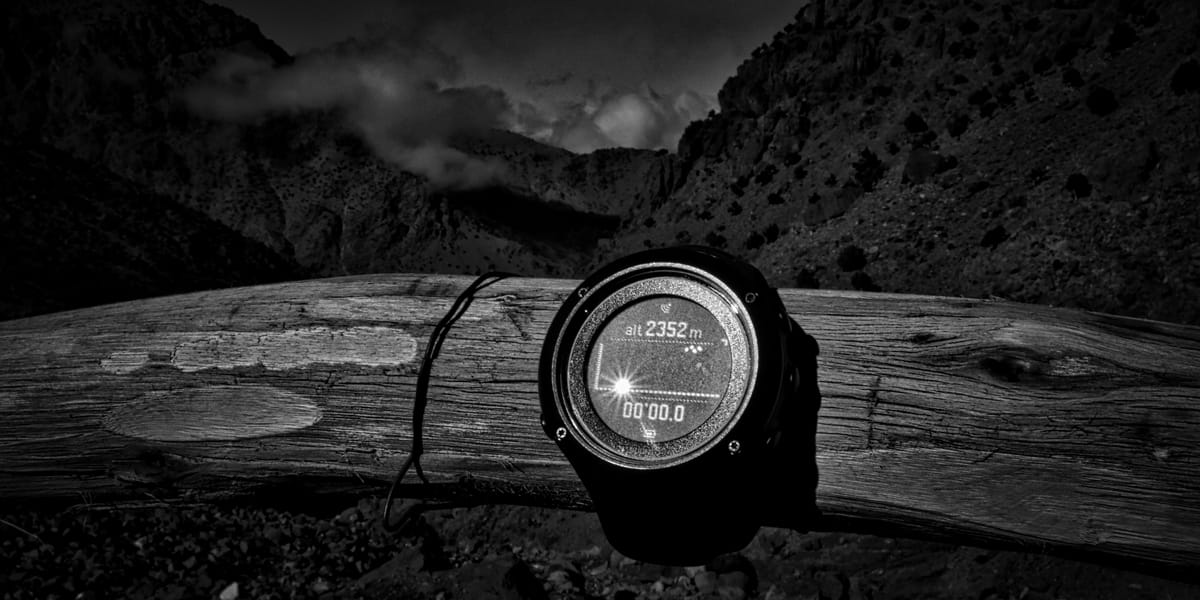
Day one began in the town of Imlil, a small village in the high Atlas Mountains, at 1,740m. We stopped after 40 minutes of hiking to load up on carbs and juices. Here, I strapped on the watch that would have made Ian Fleming jealous. At 2,353m, I was excited at the prospect of having my every move recorded and monitored. I was quite impressed at how quickly the watch found the GPS satellites. It would read, “searching for GPS” and alas, seconds later, “GPS found”.
A strenuous yet gorgeous hike- walking through clouds and sunshine- we finally reached the “Refuge du Toubkal”. My watch told me we covered 5.22 km in 3:27 hours at an average speed of 1.5 km/h and a maximum speed of 6.7km/h. This watch seemed to be reaffirming my notion that I was majorly out of shape, and unfortunately, I couldn’t prove it wrong. My battery was down to 57% from 100% in three and a half hours (using the GPS constantly drains it a lot quicker). We had ascended 815 m and were ready to sleep before the next day’s early start. Due to extreme weather conditions, we couldn’t leave at the planned 3am. Groggy and tired, after sleeping in a shared dormitory-style room, with many snorers- who looked guilty at the breakfast table; we got decked up and departed at 8am.
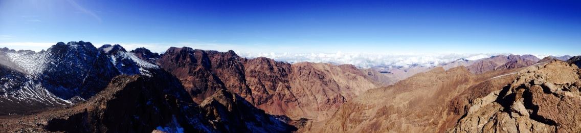
Toubkal in November is not a hike. We were scrambling on all fours, using our hands and feet to navigate icy rocks and packed snow. The route was sketchy- to say the least. “Oh don’t worry, it’s just half-an-hour away”, said our always-smiling-guide. I’m convinced this is a universal line every guide uses all around the world. I’ve fallen for it oh-so-many times. They should say “oh, don’t worry, it’s just many, many half-an-hours away”. Slipping, falling, and breathing way too heavily for a 22-year-old, Toubkal was kicking my behind.
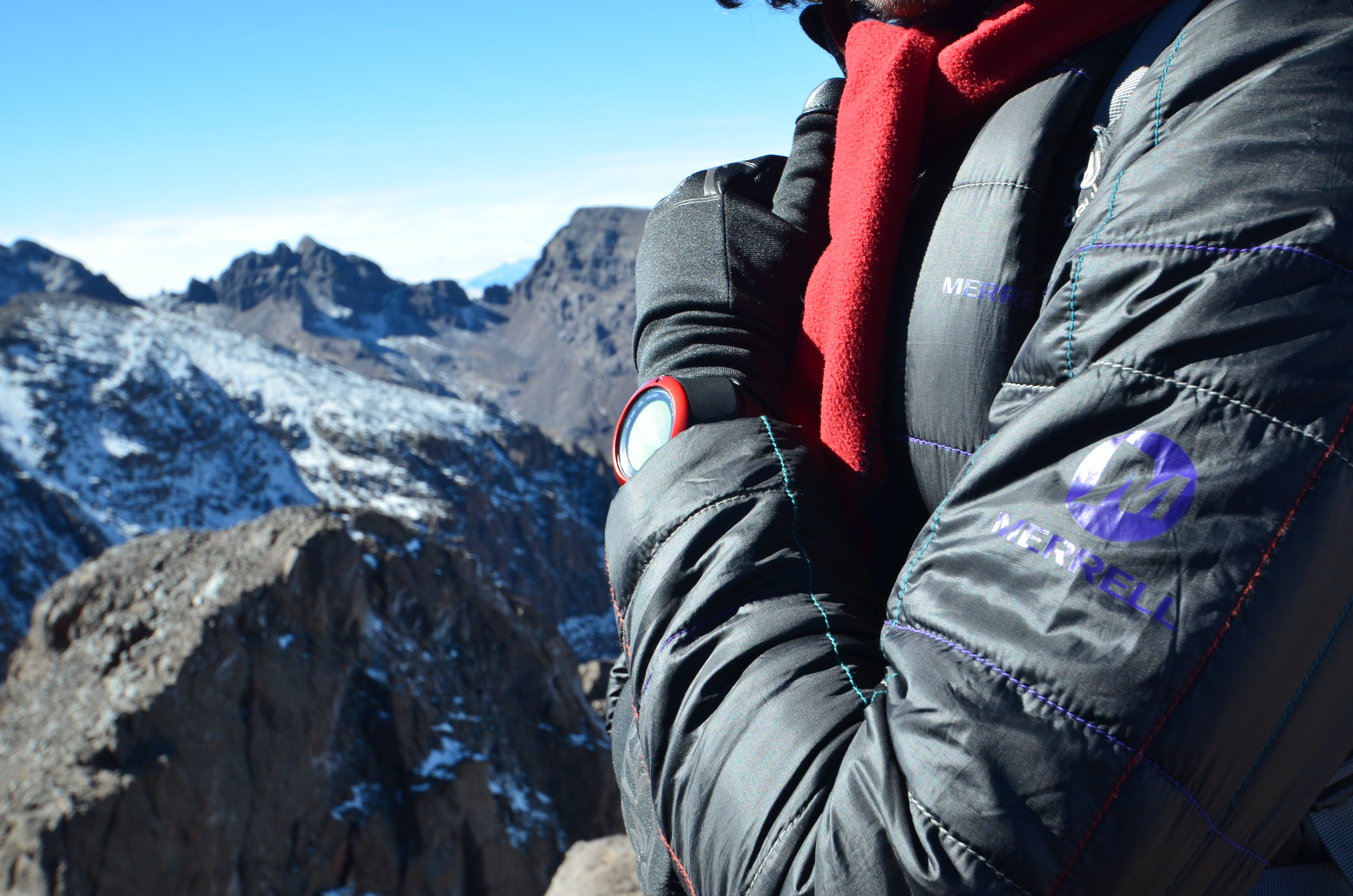
Since my cool new watch was meant to be scratch resistant and waterproof up to 50m, I didn’t care that it was getting bumped, and snowed upon. Spoiler: It is not scratch resistant. In fact, it scratches very easily- at 15.5mm, it’s a bulky watch, and the outer ring (colored) is vulnerable. However, it feels very comfortable, and at 72g, it’s pretty lightweight. I was disappointed that it didn’t have a barometric altimeter - it would be great to always know your altitude without having to use it through the GPS function. The altimeter would measure air pressure and also enable weather predictions. The Ambit 2, a previous, costlier model, does have this function, for those who want this function at their fingertips.
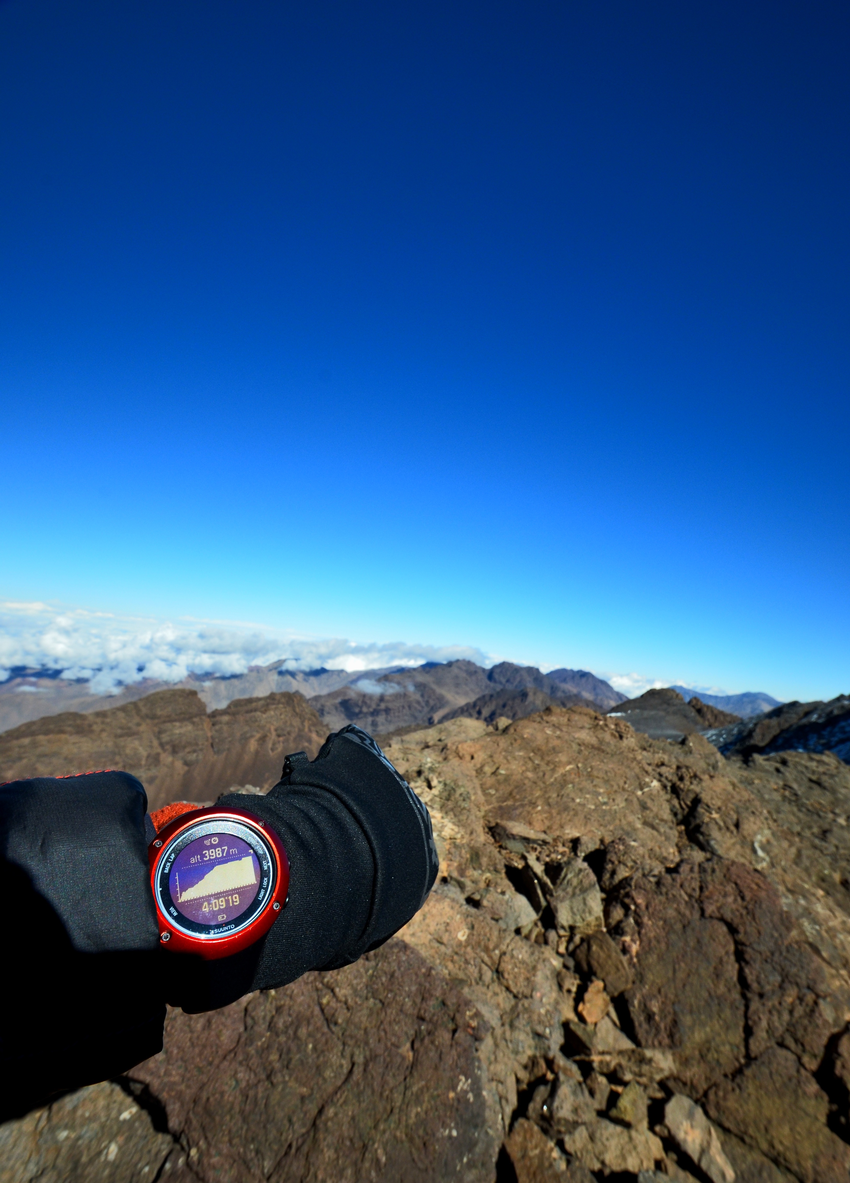
Reaching the almost-summit was breathtaking. We were at 3,987m- about 180m short of the summit- when we had to turn back. Dark, looming clouds were rolling in to steal our thunder. We had to move quickly, or we would be hiking down in a snowstorm. Upset that we couldn’t make it all the way to the top, but overwhelmed to be on top of the clouds, we began our downhill hike. Sure enough, the clouds sneakily caught up to us, blinded us, and forced us to slide down on our butts for most of the way. Our legs feeling like jelly, we finally got back down to the refuge.
The first thing I did was check my Suunto - we had taken 6:29 hours to cover 6.37 km. While it sounds terrible, I wasn’t surprised- we had ascended 1,279m. Most fourteen thousand meter peaks I had climbed had been cakewalks in comparison. We apparently needed crampons and ice-picks for the climb - oops. My battery was down to 0% from 87%. While in general, the battery life is impressive, I had been using the GPS non-stop, which is like driving a Hummer for a half-hour with a full tank.
The best way to view all your data if you want to review it is to connect your watch to a computer and sync all the data to www.movescount.com. A website powered by Suunto, you can buy customized apps, store every detailed workout, create your own training program, and share your achievements with the movescount community.
My verdict: A great watch for Triathletes and Ironmen, it works well for hikers and trail runners as well. With an array of different apps available online, it’s super customizable. The 15-day battery life is an appealing feature too. However, a barometric altimeter would be very helpful, and at about $500, a cheaper price would be nice. Personally, as a hiker and climber I prefer the Suunto Ambit 2.

Comments ()